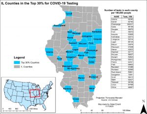
GIS Workshop on Mapping COVID-19, Dr. Yun Zhao and Dr. Junu Shrestha
On November 14, 2020, the GIS Lab, joined by Junu Shrestha from the UIS Public Health Department, offered a virtual GIS workshop titled “Mapping COVID-19 Using GIS.” The workshop introduced the use of desktop and online GIS tools in visualizing COVID- 19 to help in the decision-making process. Two example products are included here. This is the first time the GIS Lab offered an online workshop. Watch for future workshop offerings, which are open to UIS students, faculty, and staff and community members.


