


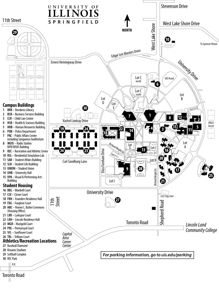
Google Map of UIS Campus
Other Maps
- View a layered UIS OpenStreetMap
- View an annotated UIS Google Map
- View UIS from Mapquest
- Global Experience Programs Google Map
- Volunteer Center Google Map
- Google Earth with UIS campus buildings
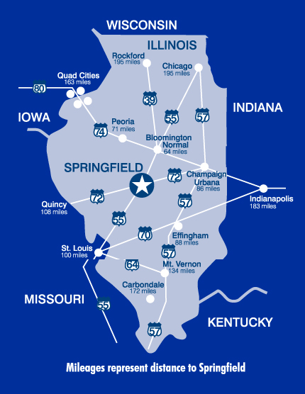
Map of Illinois
Map of Springfield, Illinois
